By LCN Business Desk
A corridor is drawn before the owners inside it are known.
What does the Order do?
It declares a road a public work and authorises entry onto the land it crosses.
Order No. 182 of 2026 was gazetted on 10 October 2026. It was made under sections 3 and 4 of the Acquisition of Lands for Public Purposes Act, Cap. 62:05, and signed by Juan Edghill, Minister of Public Works. It is cited as the Acquisition of Lands for Public Purposes (Road Extension, Heroes Highway to Ogle/Timehri Highway) Order, 2026.
Clause 2 declares the proposed construction a public work. The road commences "from the eastern side of the Heroes Highway road reserve between Plantations Providence and Peter's Hall" and runs east to "the western boundary of the Ogle/Timehri road reserve on the East Bank and East Coast of Demerara", passing through the lands in the schedule.
Clause 3 authorises the Commissioner of the Lands and Surveys, together with his agents, servants or workmen, to enter the land "for the purpose of surveying or otherwise examining such lands with a view to the acquisition of the whole or part thereof for the public work aforesaid."
Which land is inside the corridor?
The Order does not say. It promises a cadastral survey instead.
The schedule identifies the corridor on a sketch plan prepared by the Surveys Division of the Guyana Lands and Surveys Commission, Cos Plan no. 1709 dated 14 August 2026, by M. S. Hutson, Deputy Commissioner and sworn land surveyor.
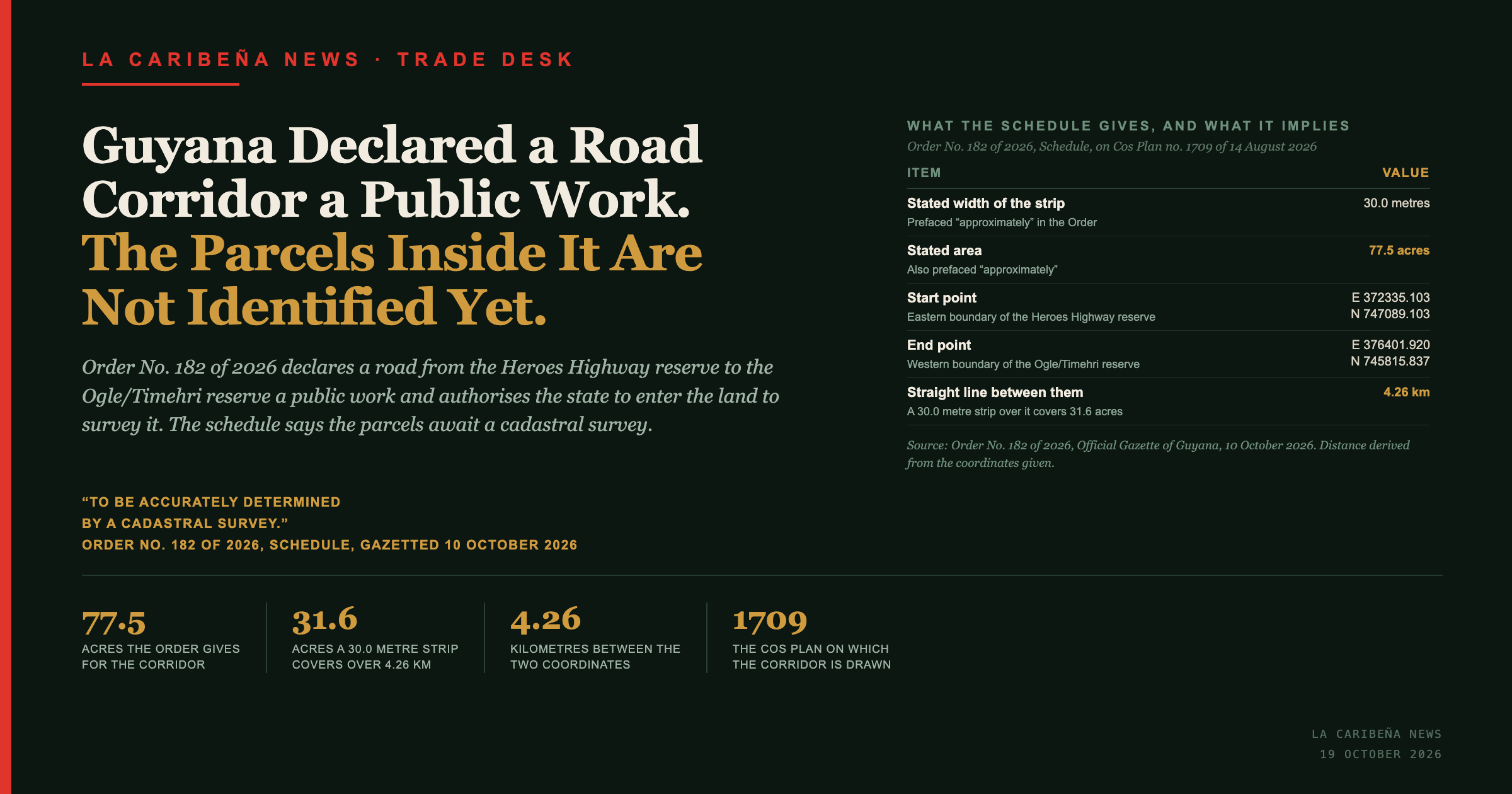
It describes "a strip of land bordered in red approximately 30.0 metres wide", running between two points given in UTM WGS 84 coordinates, "enclosing an area of approximately 77.5 acres".
Then it adds the sentence that matters most to anyone who owns land along the route: "The Parcels within the above mentioned Plantations and other lands are to be accurately determined by a Cadastral Survey."
So the corridor exists and the parcels inside it do not yet, as a matter of record.
What do the coordinates give?
Two points 4.26 kilometres apart.
| UTM WGS 84 | |
|---|---|
| Start, eastern boundary of the Heroes Highway reserve between Providence and Peter's Hall | E 372335.103, N 747089.103 |
| End, western boundary of the Ogle/Timehri road reserve | E 376401.920, N 745815.837 |
Source: Order No. 182 of 2026, Schedule.
The two points are 4,067 metres apart east to west and 1,273 metres apart north to south, which is 4,261 metres, or 4.26 kilometres, in a straight line.
Does the stated area match the stated width?
Not on a straight line between the two coordinates.
A strip 30.0 metres wide running 4,261 metres covers about 31.6 acres. The Order states approximately 77.5 acres. To enclose 77.5 acres at 30.0 metres wide, the strip would have to run about 10,450 metres, which is two and a half times the distance between its own endpoints.
Both figures in the Order are prefaced "approximately". An alignment considerably longer than the straight line between its endpoints would account for the difference, and so would an acquisition covering more than the strip itself, such as junctions or service roads. The Order describes neither, and this newspaper has not seen Cos Plan no. 1709, on which the corridor is drawn.
The coordinates, the width and the area were each read from four separate passes over the gazette page at two resolutions, and returned identical values each time.
What is a cadastral survey?
The survey that fixes the boundaries of individual parcels and gives each one the identity by which it is registered and dealt with.
The Guyana Lands and Surveys Commission Act 1999 assigns it to the Commission without defining it. Among the Commission's functions, the Act lists executing "geodetic, topographic, hydrographic and cadastral surveys in relation to the land and water resources of Guyana", specifying "the technical requirements for land surveys", and checking, approving, recording "and, where required, certify all land surveys carried out in relation to any land in Guyana". The Commission's own public description of its services lists cadastral surveying alongside engineering, topographic and occupational surveying, and also stops short of a definition.
What it produces can be read off the documents. Land that has been through the process is described by parcel, block and zone. Land that has not is described by plantation, lot and bounds.
| Description in the gazette of 10 October 2026 | Form |
|---|---|
| "Parcel: 25; Block: XVIII; Zone: West Bank Demerara", in Order No. 183 of 2026 | Parcel identifier |
| "Plots lettered 'A' and 'B' Plantation Patentia", in Order No. 184 of 2026 | Plantation and plot |
| "Plantations Providence and Peter's Hall", in Order No. 182 of 2026, with coordinates and no parcels | Plantation only |
The same day's Execution Sales notice carries both forms, and in the matter described as "Parcel: 958 Block: XXXIV Zone: W.B.D" it records that title passes "pursuant to section 124 of the Land Registry Act, Cap 5:02". So the parcel, block and zone identifier belongs to the registered land system, and it is the output a cadastral survey is directed at.
For a landowner in the path of this road, that is the practical meaning. Until the survey is carried out, checked and recorded, the corridor exists as two coordinates and a width, and no parcel has been named as falling inside it.
Who should be watching for the cadastral survey?
Anyone holding land between Providence, Peter's Hall and the Ogle/Timehri road reserve.
The Act under which the Order was made is the compulsory acquisition statute. The Order itself does not acquire anything. It declares the public work and authorises entry to survey "with a view to the acquisition of the whole or part thereof". Acquisition, and any question of compensation, follows the survey rather than this instrument.
What does this mean for the rest of the Caribbean?
That a published corridor and an identified owner are two different stages, and only the first has happened.
A landowner reading the gazette can see the two endpoints, the width and the acreage, and cannot determine whether their own parcel is inside. The instrument that will answer that is the cadastral survey the schedule promises, and no date for it appears.
The East Bank corridor already carries the Heroes Highway, and the same gazette moved more than 2,300 acres of state land to the housing authority, reported in Five Orders in One Gazette Moved 2,368 Acres Out of the State Holding Company.
The entities
- Order No. 182 of 2026 declares the road extension a public work.
- The Acquisition of Lands for Public Purposes Act, Cap. 62:05 is the statute under which it was made.
- Juan Edghill signed it as Minister of Public Works.
- Commissioner of the Lands and Surveys is authorised by clause 3 to enter the land.
- Guyana Lands and Surveys Commission prepared the sketch plan through its Surveys Division.
- Cos Plan no. 1709 is the plan on which the corridor is drawn.
- M. S. Hutson is the Deputy Commissioner and sworn land surveyor named on it.
What the title card shows
Every data point on the article's title card, in text.
- 77.5 acres. The area the Order gives for the corridor, prefaced "approximately". Source: Order No. 182 of 2026.
- 30.0 metres. The stated width of the strip, also prefaced "approximately". Source: as above.
- 4.26 kilometres. The straight-line distance between the two coordinates in the schedule. Source: derived from the coordinates given.
- 31.6 acres. What a 30.0 metre strip covers over that straight-line distance. Source: derived.
- 14 August 2026. The date of Cos Plan no. 1709. Source: as above.
- Quotation: "to be accurately determined by a Cadastral Survey", Order No. 182 of 2026, Schedule.
Frequently Asked Questions
What is Order No. 182 of 2026?
An order under sections 3 and 4 of the Acquisition of Lands for Public Purposes Act, Cap. 62:05, declaring a road extension from the Heroes Highway reserve to the Ogle/Timehri road reserve to be a public work, and authorising entry onto the land to survey it.
Where does the corridor run?
From the eastern side of the Heroes Highway road reserve between Plantations Providence and Peter's Hall, east to the western boundary of the Ogle/Timehri road reserve, on the East Bank and East Coast of Demerara.
How large is it?
The schedule describes a strip approximately 30.0 metres wide enclosing approximately 77.5 acres.
Does the Order say whose land is affected?
No. The schedule states that the parcels within the plantations and other lands "are to be accurately determined by a Cadastral Survey", and no date is given for it.
Does the Order acquire the land?
No. It declares the public work and authorises entry for surveying or examination with a view to acquisition of the whole or part. Acquisition and compensation follow separately.
Do the stated width and area agree with the coordinates?
Not on a straight line. The two coordinates are 4.26 kilometres apart, and a 30.0 metre strip over that distance covers about 31.6 acres against the 77.5 stated. A route longer than the straight line, or an acquisition wider than the strip, would account for it; the Order describes neither.
What is a cadastral survey?
The survey that fixes the boundaries of individual parcels and gives each the identity by which it is registered. The Guyana Lands and Surveys Commission Act 1999 makes executing cadastral surveys a function of the Commission, and makes the Commission responsible for checking, approving and recording all land surveys in Guyana. Neither the Act nor the Commission's published description of its services defines the term. In practice, surveyed land is described by parcel, block and zone, and unsurveyed land by plantation, lot and bounds.
Who prepared the plan?
The Surveys Division of the Guyana Lands and Surveys Commission, as Cos Plan no. 1709 dated 14 August 2026, by M. S. Hutson, Deputy Commissioner and sworn land surveyor.